This week in Cartography I tried my hand at Google Earth. Of course this was after working in ArcMap 10.2 and prepping the files for conversion to KML. I took my old dot density map in ArcMap from Module 10 (the one whose legend took longer to create than the map itself) and cleaned up the Table of Contents and symbology before attempting the conversion. In the lab we were also given the option of using a map package provided by the instructor but I figured since I spent so much time on those darn dots I would use my own map.
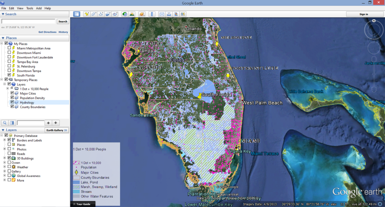 |
| Google Earth Screenshot |
Once my map was configured the way I wanted it I was ready to try the conversion. The tools are in ArcToolbox> Conversion Tools> To KML> Map to KML or Layer to KML. The first conversion I conducted was a Map to KML and I transformed all of the feature classes used in the dot density map to raster files. This prodects the files from a lot of editing changes in Google Earth and makes the files smaller. The converted file can be seen in the screenshot above under the Table of Contents>Places>Temporary Places>Layers. I also conducted a Layer to KML conversion using a shapefile marking the county boundaries in Southern Florida. This file was maintained as a vector file which created a few more options for editing it once it was opened in Google Earth. The editing in Google Earth (the free version) is not as all encompassing as ArcMap but they do give you a few options like changing fill colors and line widths. The vector file also retains the attribute data from ArcMap which can be viewed by clicking on the county polygons in when the file is open in Google Earth.
After converting the files and exploring Google Earth for a bit I added Placemarks to my map and Recorded a Tour. This was a pretty neat feature but I wish I could have figured out a way to pause the recording to turn features on and off. I must have recorded at least 12 tours just trying to figure out where to set the snapshot views for each place mark and when to turn layers on and off. Overall I enjoyed this week's lab but I like the more dynamic features of ArcGIS better than Google Earth.
No comments:
Post a Comment