As for the lab, it started with working with a landcover raster. For this raster I selected all three categories of forests in teh landcover types and used the RemapValue to list them along with the new values I wanted to give them. Then I used the Reclassify tool to reclassify the landcover raster based on those new values. The second raster I worked with was an elevation raster. I used the Slope and Aspect tools to create two temporary rasters based on the original elevation raster. These temporary rasters were used to create four more temporary rasters marking the high and low limits for the slope and aspect criteria. Using map algebra I combined the high and low limits as well as the reclassified forest raster with the "&" (and) character to create the final raster shown below. Finally I used the save method to permanently save only this last file. The final raster contains only two values to identify areas that do or do not meet all of the required criteria.
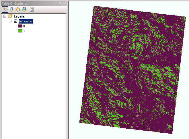 |
| Raster showing areas meeting slope, aspect, and landcover criteria |
No comments:
Post a Comment